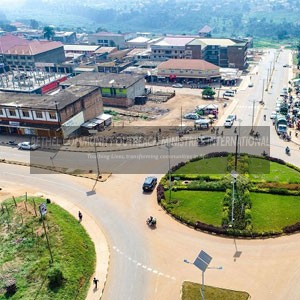
Masaka is a city in the Buganda Region of Uganda, west of Lake Victoria.[2] The city is the headquarters of Masaka District.[3]
Location
Masaka is approximately 132 kilometres (82 mi) to the south-west of Kampala on the highway to Mbarara.[4] The city is close to the Equator. The coordinates of Masaka are 0°20’28.0″S, 31°44’10.0″E (Latitude:-0.341111; Longitude:31.736111).[5] Masaka lies at an average elevation of 1,288 metres (4,226 ft) above sea level.[6]
History
Masaka was founded as a township in 1953. It became a town council in 1958 and a municipality in 1968.[7]
Masaka was a strategically important location during the Uganda–Tanzania War (1978–79), and was accordingly garrisoned by Uganda Army troops. These soldiers terrorized the local civilians, and most fled the town. On 23–24 February 1979, the Tanzania People’s Defence Force and allied Ugandan rebels attacked the settlement, resulting in the Battle of Masaka. The town was bombarded with artillery, and fell to the Tanzanian-led forces after light resistance. The Tanzanians subsequently levelled much of the town to take revenge for atrocities committed by the Uganda Army during its previous invasion of northwestern Tanzania.[8]
In course of the Ugandan Bush War, Masaka again suffered from fighting. The town was garrisoned by the Uganda National Liberation Army which served as Uganda’s national army at the time. In late 1985, National Resistance Army rebels laid siege to the town. After heavy combat, Masaka’s garrison surrendered on 10 December 1985.[9]
In 2019 the Cabinet of Uganda, resolved to award Masaka, city status effective July 2023.[2][10] In November of the same year, Cabinet revised the date of city status to 1 July 2020.[11]
Population
According to the 2002 national census, the population of Masaka was about 67,800. In 2010, the Uganda Bureau of Statistics (UBOS) estimated the population at 73,300. In 2011, UBOS estimated the mid-year population at 74,100.[12] In August 2014, the national population census put the population at 103,829.[1]
Overview

Maize plantation in Masaka
In 2016, before the metropolis attained city stratus, Masaka occupied 58 square kilometres (22 sq mi). It was divided into three administrative divisions, (a) Katwe-Butego (b) Kimaanya-Kyabakuza and (c) Nyendo-Ssenyange. It is further subdivided into 54 zones.[7]
The annual Uganda Marathon event takes place in June, the race route loops twice through the town and the funds generated support local employment and community development.[citation needed]
Source: https://en.wikipedia.org/wiki/Masaka